The 2025 Atlantic hurricane season just got a lot more interesting. Tropical Storm Erin formed Monday morning in the eastern Atlantic Ocean and forecasters expect it to become the first hurricane of the Atlantic season, marking a significant milestone in what meteorologists are calling a potentially active season ahead.
If you’ve been keeping an eye on weather patterns this summer, you’ll want to pay close attention to this developing story. Erin has formed in the eastern Atlantic and is forecast to be the first hurricane and first major hurricane of the 2025 Atlantic season, and early predictions suggest this could be a textbook example of how Atlantic hurricanes develop and strengthen.
Let me walk you through everything we know about Tropical Storm Erin so far, what makes this storm particularly noteworthy, and what it could mean for coastal communities in the coming weeks.
Current Status: Where Tropical Storm Erin Stands Right Now
As of the latest updates, Tropical Storm Erin has formed just west of the Cabo Verde Islands, positioning it in what hurricane researchers call the “birthplace” of Atlantic hurricanes. This location is significant because it’s where many of the most powerful Atlantic hurricanes begin their journey across the ocean.
Current wind speed 45mph. Max 115mph according to live tracking data, which puts Erin firmly in tropical storm category but with the potential for dramatic strengthening ahead. The storm’s current trajectory and environmental conditions suggest we’re looking at the early stages of what could become a formidable hurricane system.
What’s particularly interesting about Erin’s current position is that it emerged from a well-defined tropical wave off the West African coast – a pattern that often produces some of the Atlantic’s most significant hurricanes. These “Cape Verde” storms, as they’re sometimes called, have the advantage of traveling across thousands of miles of warm ocean water, giving them plenty of fuel to grow stronger.
The Science Behind Erin’s Formation and Strengthening
Understanding how Tropical Storm Erin developed helps us appreciate why meteorologists are taking this system so seriously. The system is moving through a portion of the Atlantic known as the “main development region,” which stretches from Africa’s west coast toward the Caribbean – essentially hurricane highway.
This main development region is like a conveyor belt for tropical development during peak hurricane season. The combination of warm sea surface temperatures, low wind shear, and atmospheric instability creates perfect conditions for storms to organize and intensify. Think of it like a natural greenhouse where tropical disturbances can flourish.
Erin will head toward warmer waters in the coming days, allowing it to strengthen into a hurricane. This is crucial because sea surface temperatures act like fuel for hurricanes – the warmer the water, the more energy available for the storm to tap into. Current ocean temperatures along Erin’s projected path are running above average, which explains why forecasters are confident about strengthening.
The atmospheric setup around Erin is also favorable for development. Low wind shear means there aren’t strong upper-level winds to tear the storm apart as it tries to organize. It’s like having calm air above while the storm spins up below – ideal conditions for a tropical cyclone to maintain its structure and grow stronger.

Forecast Track: Where Is Tropical Storm Erin Heading?
This is the million-dollar question that everyone from emergency managers to beachgoers wants answered. This system is expected to continue moving west to west-northwest at 15 to 20 mph across the eastern and central tropical Atlantic, putting it on a collision course with increasingly warm waters.
Tropical Storm Erin is forecast to track in the direction of the U.S. coast and reach major hurricane strength by this weekend. However, it’s important to understand that hurricane track forecasting this far out involves significant uncertainty. While we can be reasonably confident about the general direction, the exact landfall location – if any – remains unclear.
Long-range forecast models are showing some interesting patterns. The American GFS and European ECMWF models, which are the gold standards in weather forecasting, suggest Erin could approach the Eastern United States. But here’s where it gets complicated – atmospheric steering patterns can change, high-pressure systems can shift, and small changes in these factors can mean the difference between a direct hit and a storm that curves harmlessly out to sea.
What we can say with more confidence is that Model agreement on strength between the American GFS and the European ECMWF, indicate Erin could approach the east coast of the U.S., causing swells and rip currents in coastal areas. Even if Erin doesn’t make landfall, its effects will likely be felt along the Eastern Seaboard.
Hurricane Strength Predictions: Could Erin Become a Major Hurricane?
Here’s where Tropical Storm Erin gets really interesting from a meteorological standpoint. Erin is predicted to hit Category 3 strength by this weekend, which would classify it as a major hurricane – the first of the 2025 season.
To put this in perspective, a Category 3 hurricane packs winds of 111-129 mph, capable of causing devastating damage to well-built homes, snapping or uprooting many trees, and making areas uninhabitable for weeks or months. It’s the point where hurricanes transition from dangerous to potentially catastrophic.
Tropical Storm Erin was named the fifth hurricane of the season, forecasted to be a major hurricane by the weekend. The rapid intensification forecast is based on several favorable factors: extremely warm sea surface temperatures, low wind shear, and good upper-level divergence that helps the storm exhale air efficiently.
The science of rapid intensification is fascinating and somewhat unpredictable. We’ve seen storms go from tropical storm strength to major hurricane status in less than 24 hours when conditions are perfect. While Erin isn’t expected to intensify quite that quickly, the gradual strengthening over warm waters could produce a powerful, well-organized hurricane system.
What makes meteorologists particularly concerned about potential rapid intensification is that it can catch people off guard. Even with modern forecasting technology, predicting exactly when and how much a storm will strengthen remains one of the biggest challenges in hurricane forecasting.
Historical Context: What Past Storms Tell Us About Erin’s Potential
To understand Tropical Storm Erin’s potential impact, it helps to look at historical storms that followed similar patterns. Classic Cape Verde hurricanes – those that form near the African coast and travel across the Atlantic – include some of the most memorable storms in Atlantic hurricane history.
Consider Hurricane Hugo in 1989, which formed in a similar location and eventually devastated South Carolina. Or Hurricane Frances and Jeanne in 2004, both Cape Verde storms that caused billions in damage. These storms share common characteristics: long track across warm Atlantic waters, gradual strengthening, and the potential for major impacts when they reach populated coastlines.
The 2025 Atlantic hurricane season has already produced five named storms, with Erin being the latest addition. This puts the season slightly ahead of the average pace, which typically sees the fifth named storm around August 22nd. The early activity, combined with exceptionally warm ocean temperatures, has hurricane experts watching closely for signs of an active season ahead.
What’s particularly noteworthy about this year is the lack of significant wind shear across the Atlantic basin. Wind shear acts like a natural hurricane suppressor, tearing apart storms before they can strengthen. With minimal shear predicted to continue through August and September – peak hurricane season – conditions remain favorable for storm development and intensification.

Potential Impacts on Coastal Communities
While it’s still too early to specify exact impacts, coastal communities from Florida to North Carolina should start paying attention to Tropical Storm Erin’s progress. Even if the storm doesn’t make direct landfall, its influence will likely be felt across a broad area.
Long-range forecast models, including the American GFS and the European ECMWF, indicate Erin could approach the east coast of the U.S., causing swells and rip currents in coastal areas. These impacts often begin days before a storm’s closest approach, affecting beach conditions and maritime activities.
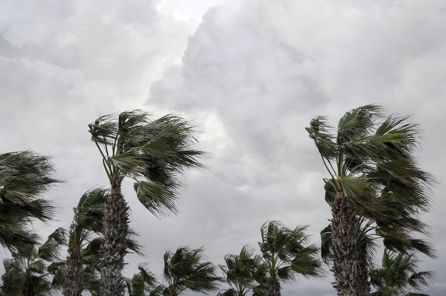
Dangerous surf conditions are often the first sign of an approaching hurricane system. Large swells generated by the storm can travel hundreds of miles ahead of the center, creating life-threatening rip currents and hazardous beach conditions. Coastal residents and visitors should monitor local beach forecasts closely as Erin approaches.
For maritime interests, this storm represents a significant concern. Shipping lanes across the Atlantic could be affected, and recreational boaters should stay informed about Erin’s track and intensity. The combination of large swells, gusty winds, and reduced visibility can create dangerous conditions even far from the storm center.
Tourism and coastal businesses should also begin considering contingency plans. While it’s too early for specific evacuations or closures, having plans in place allows for quick action if Erin’s track becomes clearer and more threatening.
Preparedness: What You Should Do Now
Even though Tropical Storm Erin is still developing and its ultimate track remains uncertain, now is the perfect time to review your hurricane preparedness plans. Don’t wait until the storm is knocking on your door to think about preparation.
Start with the basics: ensure you have adequate supplies for at least three days without power or outside assistance. This includes water (one gallon per person per day), non-perishable food, battery-powered or hand-crank radio, flashlights, first aid kit, and any necessary medications. These supplies are useful for any emergency, not just hurricanes.
Review your insurance coverage and document your property with photos or video. Many people don’t realize that standard homeowner’s insurance doesn’t cover flood damage – that requires separate flood insurance, which typically has a 30-day waiting period. While it’s too late to get new flood coverage for Erin specifically, it’s worth considering for future seasons.
Develop or review your family emergency plan. Know your evacuation routes, identify where you’ll go if you need to leave, and establish communication plans with family members. In the digital age, consider how you’ll charge devices and access information if power is out for extended periods.
For those in hurricane-prone areas, consider investing in protective measures like storm shutters, backup generators, or whole-house surge protectors. These investments pay dividends when severe weather strikes and can significantly reduce both property damage and personal stress.
Related Article: Legionnaires Disease: What Every Building Owner and Health-Conscious Person Needs to Know
The Broader Context: Climate Change and Hurricane Activity
Tropical Storm Erin’s development occurs against the backdrop of changing climate patterns that are influencing hurricane activity. While no single storm can be attributed directly to climate change, the broader trends are worth understanding.
Ocean temperatures across the Atlantic are running significantly above average this year, providing more energy for tropical cyclone development and intensification. Warmer waters don’t necessarily create more storms, but they can make the storms that do form stronger and potentially more destructive.
Scientists have observed that while the total number of Atlantic hurricanes may not be increasing dramatically, there’s growing evidence that more storms are reaching major hurricane status (Category 3-5). This trend toward stronger storms has important implications for coastal communities and emergency planning.
The phenomenon of rapid intensification – where storms strengthen very quickly – appears to be becoming more common. This makes forecasting more challenging and gives coastal communities less time to prepare when a storm suddenly becomes dangerous.
Research also suggests that hurricanes are moving more slowly on average, which can increase rainfall totals and flooding impacts when they do affect land areas. A slower-moving storm drops more rain over the same area, potentially causing more devastating flood damage.

Technology and Forecasting: How To Track Storms Like Erin
The ability to monitor and predict Tropical Storm Erin’s behavior represents decades of advances in meteorological science and technology. Hurricane hunters – specially equipped aircraft that fly directly into storms – provide crucial data about wind speeds, pressure, and storm structure that can’t be obtained any other way.
Satellite technology allows meteorologists to watch storms develop in real-time, tracking cloud patterns, measuring temperatures, and assessing atmospheric conditions around the storm. The latest generation of weather satellites provides incredibly detailed imagery every few minutes, giving forecasters unprecedented insight into storm behavior.
Computer modeling has revolutionized hurricane track and intensity forecasting. Multiple sophisticated models run scenarios based on current atmospheric conditions, ocean temperatures, and physical laws governing storm behavior. While no model is perfect, the consensus of multiple models provides increasingly reliable guidance about storm movement and development.
The National Hurricane Center synthesizes all this information into forecasts and warnings that help communities prepare. Their track forecasts have improved dramatically over recent decades – today’s five-day track forecast is as accurate as the three-day forecast was in the 1990s.
Also Checkout: Krea AI: Unlocking The Potential Of Krea AI
Economic and Social Implications
The formation of Tropical Storm Erin and its potential strengthening into a major hurricane carries significant economic implications beyond direct property damage. Hurricane seasons affect everything from insurance markets to agricultural commodity prices to tourism revenue across the Atlantic and Gulf coasts.
Energy markets closely watch developing storms, as hurricanes can disrupt oil and gas production in the Gulf of Mexico and affect refinery operations along the coast. Even storms that don’t directly impact energy infrastructure can influence prices through market psychology and supply chain concerns.
The insurance industry uses sophisticated modeling to assess hurricane risk and set premiums. A active hurricane season like 2025 appears to be shaping up to be can influence insurance costs for years to come, particularly in high-risk coastal areas.
Tourism-dependent communities from the Caribbean to the Carolinas watch hurricane development closely, as even the threat of a major storm can significantly impact visitor bookings and economic activity. The timing of Erin’s development during peak summer tourism season adds another layer of economic concern.
FAQ Section
When is Tropical Storm Erin expected to become a hurricane?
Forecasters expect it to become the first hurricane of the Atlantic season as early as Wednesday. The storm is moving through favorable conditions that should allow for steady strengthening over the coming days.
Could Tropical Storm Erin affect the United States mainland?
It’s possible but still uncertain. Long-range forecast models, including the American GFS and the European ECMWF, indicate Erin could approach the east coast of the U.S., but track forecasts beyond five days have significant uncertainty.
How strong could Tropical Storm Erin become?
Erin is predicted to hit Category 3 strength by this weekend, which would make it a major hurricane with winds between 111-129 mph. Some forecasts suggest it could become even stronger under ideal conditions.
What areas should be monitoring Tropical Storm Erin closely?
Anyone along the U.S. East Coast from Florida to the Carolinas should stay informed about Erin’s development and track. Even if the storm doesn’t make landfall, it could generate dangerous surf and rip current conditions.
Is Tropical Storm Erin unusually early or strong for this time of year?
Tropical Storm Erin formed in the eastern Atlantic Ocean on Monday, becoming the fifth named storm of the Atlantic hurricane season. This timing is actually slightly ahead of the historical average, suggesting an active season ahead.
What makes this storm particularly concerning to meteorologists?
Erin formed in the main development region of the Atlantic and will be traveling over very warm ocean waters with low wind shear – ideal conditions for strengthening. Erin will be a long-track storm and will eye the United States next week.
Conclusion: Staying Informed and Prepared
Tropical Storm Erin represents exactly why hurricane season demands our attention and respect. From its formation near the Cape Verde Islands to its potential evolution into the first major hurricane of 2025, this storm embodies the dynamic and potentially dangerous nature of Atlantic tropical cyclones.
The key takeaway isn’t to panic about Erin specifically, but to use its development as a reminder that we’re in the heart of hurricane season. Whether Erin ultimately affects your community directly or passes harmlessly out to sea, it serves as an important catalyst for preparation and planning.
Stay informed through reliable sources like the National Hurricane Center, local National Weather Service offices, and trusted media outlets. Avoid social media speculation and stick to official forecasts and updates. Remember that hurricane tracks and intensity forecasts improve significantly as storms get closer, so don’t make major decisions based on extended forecasts.
Most importantly, use Tropical Storm Erin’s formation as motivation to complete any hurricane preparedness tasks you’ve been putting off. Review your emergency supplies, update your family communication plan, and ensure you’re ready for whatever the remainder of the 2025 hurricane season might bring.
The science of hurricane forecasting has come remarkably far, but Mother Nature still holds many cards close to her vest. By staying informed, remaining prepared, and respecting the power of these natural phenomena, we can navigate hurricane season safely and confidently, regardless of what storms like Erin ultimately decide to do.
As we continue to track Tropical Storm Erin’s development into what could become the first major hurricane of 2025, remember that preparation and awareness are your best defenses against whatever this hurricane season might bring your way.